This guide describes a walking tour of the Nottingham Solar System Model of approximately 10 km (6 miles) length.
The walk is divided into four sections:
Nottingham Castle to Hillside
Hillside to Jupiter
Jupiter to Uranus
Uranus to Neptune
The first two stages are on easy, level paths. Sections of the last two stages are undulating and can be
muddy after rain. Stout footwear and suitable clothing are recommended. Information about public transport
is given to enable each stage to be walked separately. Refreshments are available in Wollaton Park and at
the end of the walk.
Walking Route from Nottingham Castle to Hillside
(This section of the walk may alternatively by travelled by public transport.)
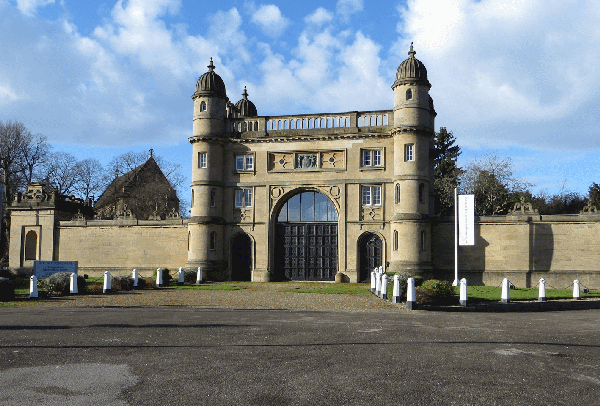
PLUTO is located on the terrace in
Nottingham Castle. There is generally an admission charge
to enter the Castle.
Leaving the Castle by the Gatehouse, turn sharp right and go down the road
by the side of the Castle. Turn left at the end and use the next
pedestrian crossing to reach the right-hand side of Wilford Street. In 80m
cross the Beeston Canal and descend to the towpath. Continue on the
towpath for 1.6 km (1 mile), passing under a footbridge, a road bridge, a
railway bridge, and another road bridge.
At the second road bridge go up the incline on the far side and turn left
over the canal. Follow the road and go straight on at the next crossroads
over the pedestrian crossing. Just past the White Hart pub turn left into
Leen Gate. After 200m cross over the River Leen and turn right into the
footpath that runs beside it. The path continues as a road which emerges
onto Derby Road close to Hillside bus stop.
Walking Route from Hillside to Jupiter
On the opposite side of Derby Road is the old Lodge of the Wollaton
Estate. Go over the pedestrian crossing and enter the footpath at the
right-hand side of the Lodge. Bear left where the path emerges onto a road
and continue to the Ring Road (dual carriageway). Go over the pedestrian
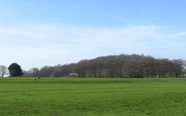
crossing and bear left to reach the entrance into
Wollaton Park. Walk down the Lime Tree Avenue and locate
SATURN just before the ornate iron gates.
Pass through the narrow middle gate in the fence and continue along the
Avenue towards Wollaton Hall. Shortly after a right bend in the path, take
the narrow footpath branching left up the hill. Follow the path to the
gate into Wollaton Hall Gardens, which is on the left just before the path
arrives at the front of Wollaton Hall. Enter the Gardens and locate VENUS.
Continue to the Circular Pond which is situated in a central position to
the rear of the Hall. The centre of the Pond marks the location of the SUN.
Locate MERCURY on the opposite side of
the formal gardens.
Descend the steps from the terrace into the tree-planted area away from
the Hall. Locate the EARTH and MOON among
the trees.
From here, find the Classical style shelter where MARS
is located.
Follow the path in front of the shelter around the edge of the Gardens.
Turn right in front of the Camellia House and then left when you reach it.
Straight ahead, find a narrow descending path and follow it to exit from
the Gardens. The path leads to the Yard building where a cafe and toilets
are available.
Turn left in front of the building (or right, if coming out of the Yard)
and take the path which descends to the right of the Lake. Locate JUPITER beside the Lake.
Bearing half-right, enter the avenue of trees leading to the exit from
Wollaton Park. From the park gate, cross the road bearing left to enter
the road opposite. Descend to the main road, turn left and take the first
right turn into Woodbank Drive. Take the first left turn into Vines Cross,
and turn left again into Appledore Avenue. Follow this road round and take
the first right turn into Kingsdown Mount. Turn left at the top and, where
the road ends, find a footpath climbing the hill on the right.
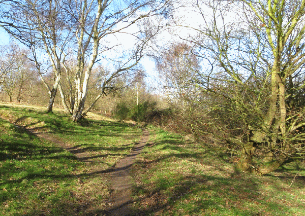
In 50m take a right turn through a gap in the fence and continue climbing.
The path runs parallel to the Sandstone Ridge but stays below it on the
North side. After 350m take the right branch where the path divides. Where
the path crosses a surfaced footway, head up the hill towards a rock
outcrop. Follow the path which climbs around the left side of the outcrop
and emerge onto the top, where URANUS is
located.
Walking Route from Uranus to Neptune
Leave the rock outcrop by the gravel path, continuing straight ahead where
it branches to the left. After 60m, where the gravel path bends left, branch
right into an unmade path with steps and descend to the road. Turn right and
after 100m find footpath signs on both sides of the road. Take the footpath
opposite, bearing left where it joins a road. Where the road bends, continue
straight along another footpath. At the end of the path turn left into a
lane, and in 30m turn right into a tarmac path. After 200m, turn left and
take the path climbing to the wood on Bramcote Hill.
Inside the wood turn to the right and, ignoring a cross-path, continue up
the hill, bearing left. At the top of the hill locate NEPTUNE. To view Wollaton Hall descend East
for 100m to the edge of the wood.
For buses back to Nottingham, turn down the hill
with the fence on your left, and take the broad path bending to the right and
contouring around the side of Bramcote Hill. In 250m the path descends to emerge
onto open parkland. Turn left into a footpath following the edge of the park,
and continue straight ahead where it enters a narrow road. After 500m the road
passes Bramcote Leisure Centre and emerges onto Derby Road (dual carriageway).
Turn left and walk 100m to the Leisure Centre bus stop.
Food and refreshments are available at the White Lion pub in Bramcote. To
find it from the Leisure Centre, turn right along the Derby Road. At the
traffic lights, cross Derby Road and go up Town Street on the opposite side.
Continue up this lane for 300m to reach the pub.